Strata Geotechnics was appointed to conduct Ground Investigation works with the primary objective of determining the underlying cause of the subsidence on the southbound carriageway at Junction 8 of the M5 motorway.
Project Background
- Appointed by National Highways on behalf of Jacobs Solutions.
- Served as the principal contractor, managing day and night operations, including site clearance, surveys (ecology, topographical, drainage, utility, GPR, FWD), drilling, excavation, reinstatement, and the installation of telematic and geotechnical instruments.
Challenges
As the principal contractor, managing multiple contractors across both day and night shifts presented the challenge of ensuring consistent communication, coordination, and supervision to maintain smooth operations throughout the project.
A further challenge was the navigation of steep embankments in wet weather, which made the ground slippery and challenging to move across. To address this, we added stairs on both sides of the trial pits to help workers move safely around the site.
The coring process required a constant water supply, so we assigned a team member to transport water in large containers whenever needed, ensuring the work continued without interruption. We also had to operate within a Traffic Management (TM) window, which limited the time we could use vehicles and equipment on site. This required careful planning to maintain efficiency while ensuring safety.
Van Elle Solutions
We managed multiple contractors efficiently to carry out a wide range of operations including: devegetation, barrier removal, ecology surveys, topographical surveys, CCTV and drainage surveys, filter drain jetting, utility scanning and clearance, and a range of geotechnical tests such as FWD and GPR surveys, borehole drilling, and carriageway coring. Additionally, we conducted trial trench excavation, reinstatement works, and installed telematic wireless gateways and geotechnical instruments for data collection and transfer.
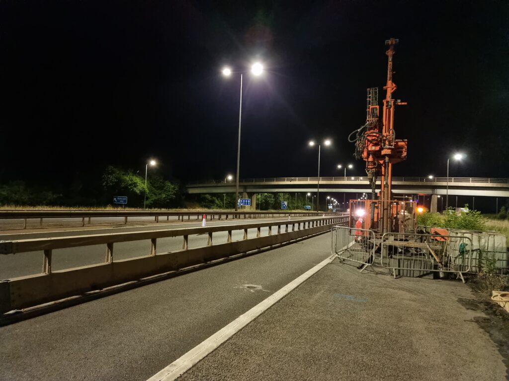
As part of the investigation, 20No. boreholes were drilled at the crest and toe of the embankment using a Commachio 405-2 drill rig. Sonic and rotary coring methods were employed to explore deep soil and rock layers. Sonic drilling using high-frequency vibrations to penetrate the geological layers allowed our teams to reach the rock head.
Rotary coring, combined with a water-flush system, extracted core samples to a depth of 30m, providing more accurate geological assessments. We also installed 6No. manual slip indicators, 4No. in-place inclinometers with cloud data capture, and 9No. vibrating wire piezometers, all designed to collect and transfer data to the cloud for client access.
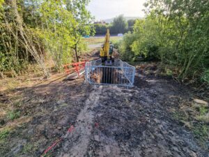
To better understand the near-surface ground material, we excavated 11No trial pits from the crest to the toe of the embankment. These pits revealed subsurface conditions, including sand bands that may have contributed to the clay subsidence. This investigation not only addressed immediate concerns but also provided valuable insights to inform the future design of the project.